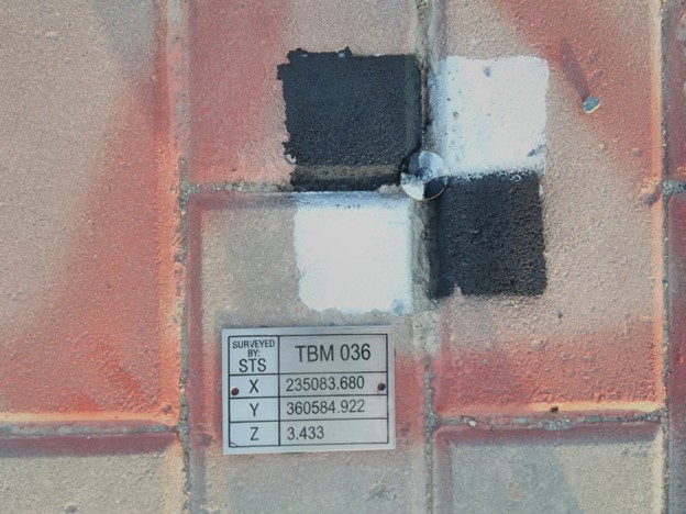
survey control points are a set of points that tie a project to real-world locations There are many different types of surveys that can be performed for real estate developments and construction projects. A survey may involve finding the existing dimensions of the building, marking underground utility locations, or locating property boundaries.
Each type of survey requires a very different type of professional. If a project utilizes survey control, then all those surveys can be coordinated into a unified digital environment that references real-world locations.
Sometimes the survey control points provided is localized to a specific project and other times it is tied to pre-established systems like a state planes coordinate system. Both methods involve marking various points on-site utilizing fixed elements like survey nails, cuts in masonry, checkerboard targets, etc., and then measuring the X, Y and Z values of those points. These points are called control points and are usually placed throughout the common areas of a project like up stairwells and through hallways. Usually, 3-4 control points are needed in order to properly align a project to the real-world coordinates collected on-site, however, having multiple control points located throughout a building, or at crucial measurement points, helps ensure a higher level of accuracy.
When STS use localized control, a special type of control point is chosen, called a basepoint, which establishes the origin of the X, Y and Z values (i.e. 0,0,0). Then all other control point locations are referenced from that basepoint.
Additionally, benchmarks serve as another type of control point utilized by STS. These points provide a singular reference point from which multiple other points can be measured.


