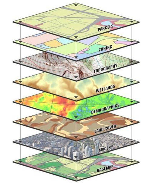
A Geographic Information System (GIS) stands as a premier tool for managing geographic information effectively. A staggering 85% of data managed by cities and counties worldwide holds some form of geographic reference, from building locations to land use patterns. Examples of such data encompass addresses, parcels, school district boundaries, road networks, and utility locations.
SURVEY TECHNOLOGIES offers a comprehensive array of GIS data development and conversion services tailored to client specifications. Our GIS Team adheres to PWA (PUBLIC WORKS AUTHORITY) GIS standards, providing customizable feature attributes aligned with ASHGHAL & KAHRAMAA specifications.
GIS data is deliverable in various ESRI formats including ArcGIS 10.X, SDE, Personal Geodatabases, File Geodatabases, and Shapefiles. Additionally, we offer data export to alternate CAD formats, ensuring seamless integration across platforms. All GIS datasets are constructed with FGDC (Federal Geographic Data Committee) compliant metadata as part of project deliverables.
Data Conversion Specifications
Document flow control
Data Conversion Specifications
Supervision of data conversions
Data Capture from hardcopy procedure
CAD to GIS Conversion procedure
Preparation of QA/QC policies and procedures
Data Entry Services include keyboard data entry, digitizing, scanning, coordinated geometry (COGO), Global Positioning Systems (GPS), and other data entry means.
Survey Technologies
leverages GIS data and map programs to enhance map accuracy and informativeness. We manipulate map data to output tables, charts, and legends, ensuring comprehensive representation.


Accurate georeferencing/geocoding of projects
Property development and community infrastructure management
Municipal land parcel management and urban planning
Mapping for oil pipelines and facilities
Utility management including electricity, water, gas, drainage, and roads
Roads As-Built facilities
Educational institutes for teaching and research
Topographical and cadastral mapping
Image GeoRectification / Georeferencing
GIS Geo databases for various network systems including District Cooling, Gas Distribution, and Pneumatic Waste Collection.
Our Geodatabases adhere to all requirements of CGIS, ensuring compliance and reliability.


