Qatar Geological Mapping Project Phase II
PROJECT CONTEXT
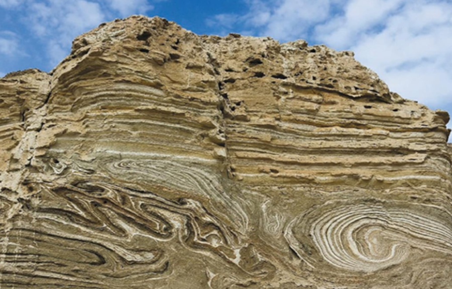
Nationally consistent geospatial geological data included at National scale geological Maps enable better national recourses and land management decisions, support scientific missions, enable the effective enforcement of regulatory responsibilities, and countless other activities. National scale geological Maps usually include information about the spatial distribution and properties of the geological formations providing at the same time key information about the lithostratigraphic structure of the country.
The Qatar Geological Mapping Project (PH II), which is being implemented under the technical supervision of the Ministry of Municipality of the State of Qatar, exceeds the purpose of establishing a simple national scale geological mapping, providing a suite of products and services that gives access to surface and subsurface geospatial information regarding the geological structure of the peninsula of Qatar and its surrounding islands

PROJECT IMPLEMENTATION
The newly acquired data sets are integrated with existing geodatabases and appropriate GIS layers;
1-Cartographic datasets and base maps,
2-Standalone or study specific hydrogeological,
3-Environmental,
4-Geophysical,
5-Remote sensing datasets/databases,
6-Bathymetric Data,
7-Geophysical Survey Data and Reports, etc.,
that will be provided by the state of Qatar.
A significant part of the QGMP PH II effort is devoted to the acquisition and the subsequent analysis of new information:
1-Earth Observation data to support the development and serve as a basis of the geological map products.,
2-Field-based geologic mapping for the designated areas at relevant scale,
3-Subsurface drilling Investigation data that include the estimation of a full set of Geological and geotechnical engineering characteristics, as well as engineering geophysical surveys.
Taking advantage of the capacities of a newly acquired 3D Geological Modeling Software, a 3D Geologic Model will be developed through adequate processing of relevant data (drill logs, cross sections, maps, geophysical data, etc.).
Design and Implementation of a Comprehensive Geoscience Database Management System (CGDMS) with desktop and web components and a mobile application on android and iOS. The Geoportal will include functionalities such as 3-D view, query, analyze and map..
PROJECT TASKS
The Project activities are distinguished in 5 vertical and 2 horizontal tasks with strictly defined time charts and deliverables.
Horizontal Activities are implemented in the context of the:
Task 1 – PROJECT MANAGEMENT AND COORDINATION and
The preparation of the deliverables starts two to three months before the finalization of each work package, in such a way that fully compliant and useful deliverables are submitted at the completion of all the sub-tasks, according to the work schedule. The dissemination of the results starts at a logical distance, from the work packages dedicated to the production of the information to be disseminated.
Vertical Activities are implemented in the context of:
The remote sensing activities precede, providing the necessary basic information for the closely following activities of the geological mapping and the Subsurface Investigation. In parallel the activities required for the establishment of the Comprehensive Geoscience Database Management System (CGDMS) are planed from the beginning of the project, aiming not only to establish the database but also to introduce the already available data sets provided from the state of Qatar. The development of the 3D Geologic Model will follow the establishment of the geodatabase summarizing and cross checking the introduced data and at the same time giving feedback for inconsistencies. The overall activities follow each other closely giving sufficient time for interaction among the various task-specific teams.
RESULTS DISSEMINATION
Publications
Several scientific publications in international peer reviewed journals to ensure good exposure and scientific impact
Conferences & Events
Sharing specific project results with a dedicated audience through selected conferences and events
Geological Synthesis Publication
A book concentrating all the knowledge collected during the QGMP – PHII project as well as other cultural, historical etc. information about the country.
Newsletter
PROJECT TEAM

Under the leadership and coordination of Survey Technologies (STS) a Class A Surveying Engineering Company, established in Qatar, and provides qualitative and integrated solutions based on modern technologies in the fields of Geodesy, Surveying, Hydrography-Geophysics, Cartography, Photogrammetry, Laser Scanning and Mobile Mapping.
Senior Experts assume the technical responsibility of the project tasks and subtasks; and guarantee the seamless and correct implementation and successful completion of the project tasks with more than 15 years experience in relevant subjects as Geotechnical Engineers, Data Applications Engineers, Remote Sensing, Geological mapping, Sedimentology, Stratigraphy, Geomorphology, Karstology, Hydrogeology, Groundwater Flow and Solute Transport Modeling, Groundwater Management, Hydrogeological modelling Data Analysis and ITC Experts, etc.
Senior Experts and other professionals involved in the project are collaborators of the STS and a number of subcontractors:

Qatar Geotechnical and Environmental (QGEC), a 100% Qatari-owned company based in Doha and owned by the Arabian Construction Engineering (www.acecgroup.com)

National Observatory of Athens (NOA) and its Earth Observation and Remote Sensing Unit of the Institute for Astronomy, Astrophysics, Space Applications and Remote Sensing, a Research Intsitution based in Athens (GR)

National Technical University of Athens (NTUA) the oldest and largest educational institution of Greece in the field of technology, and firm commitment to research thanks to its personnel and its extensive infrastructure, state-of-the-art laboratories and computing facilities

EDGE in Earth Observation Sciences, a Greek company based in Athens that accumulates cutting edge expertise in Earth Observation and provision of integrated Information/ Decision Support Systems and Solutions
PROJECT STATUS/ PROGRESS
The project, with a total duration of 36 months started the 29th of January 2024
All foreseen deliverables are submitted according to the project schedule
Monthly meetings and reports assure the systematic monitoring of the progress and efficiency and (where necessary) the priorities adjustment

